|
|
||||||||||||||||||||||||||||||||||||
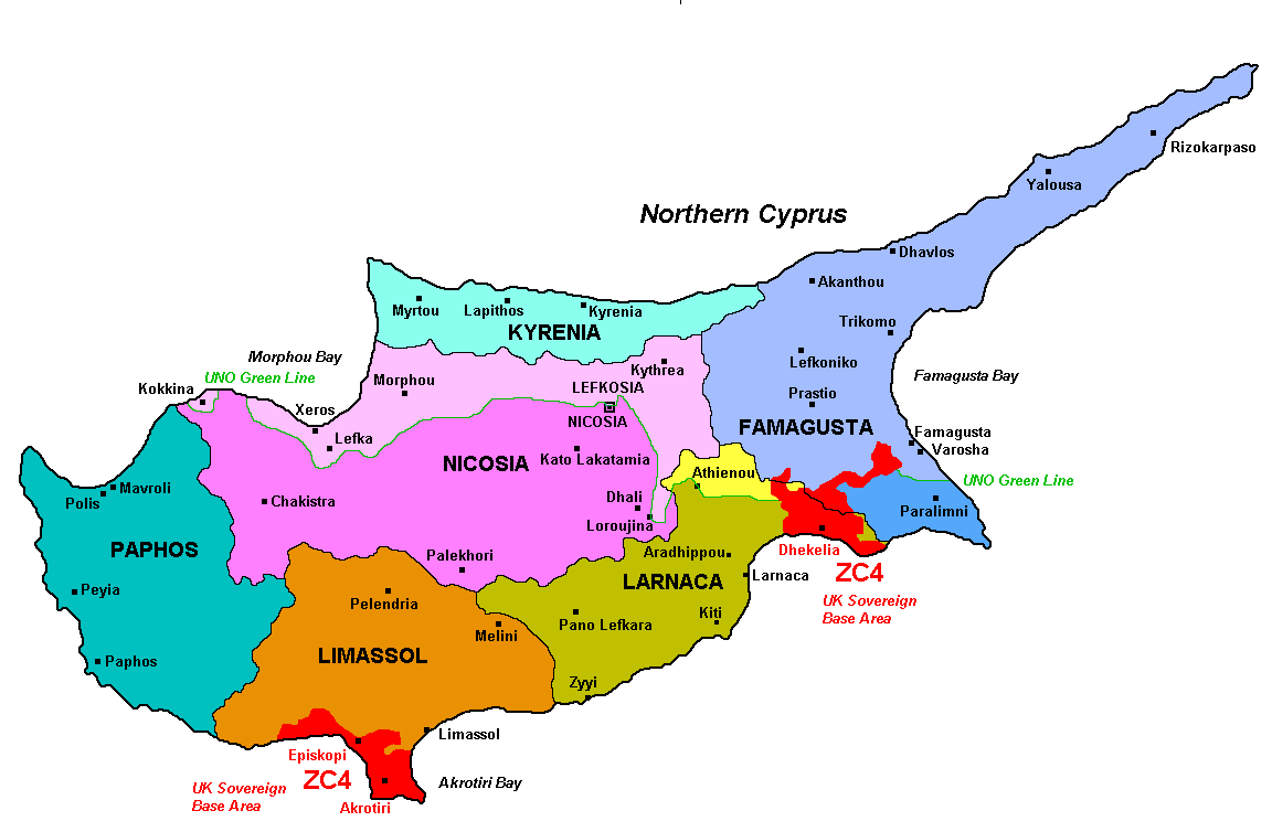 |
Cyprus is divided into 6 Districts, called "Eparchies" in greek language, and "Kaza" in turkish language. The green line divides Cyprus into two self-governed entities. The so called "Turkish Republic of Northern Cyprus" declared its independence but that does not have any international recognition, except from Turkey. For our purposes only stations using ITU legally assigned prefixes (5B, C4, H2 and P3) are valid for EUCC. Contacts with stations using 1B prefix (not issued by ITU) are NOT valid. So the Province of Kyrenia is not in the list as totally under control of the so called "Turkish Republic of Northern Cyprus". Dhekelia and Akrotiri areas (Sov. UK Bases in Cyprus) are considered as another area of Cyprus but they count for United Kingdom. To detect the District you can use Wikipedia. The main towns for each District are shown in the map. |
|||||||||||||||||||||||||||||||||||
|
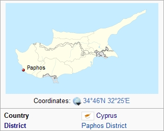
Put the QTH into the search engine of Wikipedia and you will find this:
|
|||||||||||||||||||||||||||||||||||
 This eQSL shows the QTH:
Paphos. The County is Paphos, code
CY-PA
This eQSL shows the QTH:
Paphos. The County is Paphos, code
CY-PA